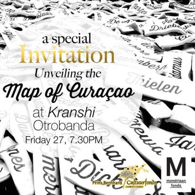
Map of Curaçao
Unveiling of a unique artwork by young visual artist Avantia Damberg: ‘Map of Curaçao’.
Friday, May 27, 2016.
Kranshi (Civil Registry)
Otrobanda
In 2014 independent art historian Jennifer Smit curated the exhibition ‘Exploring the Past to Envisage the Future’. One of the younger participating artists was Avantia Damberg, with an interactive installation ‘Map of Curaçao’. It was the onset of a new art-piece, a concept, to create a map of the island consisting of the family names of Curaçao. Avantia intended to locate where on the island each name originated, for the very first time. Visitors of the exhibition were asked to participate and leave their family name behind for the artist to research. For the past two years Avantia worked on the project and searched for the proper location to display the final product.


In 2016 Avantia Damberg could proudly unveil her unique art work together with Minister of Administration, Planning and Services Etienne van der Horst, in the company of family, friends, sponsors and art-lovers in the central hall of the civil registry in Otrobanda, Willemstad.